
Cornasaus [Moyer] [Mohercrom] [Corr na Sas]
Good walks are even better shared.
Overview
Cornasaus [Moyer] [Mohercrom] [Corr na Sas]
Introduction
Cornasaus, standing at a proud elevation of 565 meters, is an exquisite mountain nestled in the heart of the Sperrin Mountains. A true gem for hikers and nature enthusiasts, it offers varied terrain and rewarding views for those who make the trek.
Geology
This stunning mountain is primarily composed of Old Red Sandstone. The geological formations tell a story of ancient river systems and environmental changes that shaped the landscape over millions of years.
Routes
One of the most popular routes begins at Ballybofey. This moderate trail leads through lush forests and opens up to moorland, granting hikers a delightful array of sights and experiences. The round trip spans approximately 6.5 kilometers and typically takes around 2.5 hours to complete.
Summit Features
Reaching the summit, you'll be greeted by a substantial stone cairn, a hallmark of many Scottish and Irish peaks. This designated spot serves as a marker for fellow travelers and a magnificent viewpoint for all who ascend.
Terrain Type
Expect a captivating blend of grassy slopes interspersed with rocky outcrops, which can sometimes lead to an accidental game of 'how not to trip'. Remember, it's not just about reaching the summit—enjoying the journey is key!
Views
The summit reveals breathtaking views across the towering Sperrin mountains, with glimpses of the Atlantic coastline in the far distance when the weather permits. The best seasons to experience these vistas are spring and early autumn, when clarity and colours combine to create an unforgettable landscape.
Hazards
While the hike is largely rewarding, be cautious of sudden weather fluctuations. The paths can also get quite muddy following rainfall, so appropriate footwear is highly recommended to keep your footing solid and your spirits high.
Nearby Summits
If you feel adventurous and leisurely, consider exploring nearby summits such as Sliabh Beagh or Knockmoyle, both of which add to the splendid experience of the area.
Access
Accessing Cornasaus is relatively straightforward. The nearest car park is located at the Ballybofey starting point. Public transport is an option from Donegal Town; just keep an eye on the schedule! The closest town, Ballybofey, offers various facilities, including cafés and shops, ensuring you're well-fuelled before your adventure.
Facilities
Ballybofey hosts an array of cafés ready to refresh hikers post-trek, along with public toilets in the town centre, allowing you to gear up for your journey without worry.
History
The name 'Cornasaus' reflects the deep-rooted cultural heritage of this landscape, meaning 'the hill of the bushes'. The Sperrin Mountains themselves hold significant prominence in local folklore, adding an ethereal quality to your hike.
In conclusion, Cornasaus, with its majestic landscape and varied environment, is not just a mountain; it’s a retreat to nature and a gateway to stunning views that will have you grinning from ear to ear—provided you can catch your breath!
Happy hiking!
Explore routes near Cornasaus [Moyer] [Mohercrom] [Corr na Sas]
Public walks starting within 80 km of this hill. Nearby does not mean a route reaches the summit; check its map and access before setting out.
Scarva to Poyntzpass: Newry Canal and Lough Shark Return
View route
Silent Valley to Ben Crom Dam: Reservoir Road Walk, County Down
View route
Portadown to Knock Bridge: Bann Boulevard and Moneypenny’s Lock
View route
Florence Court: Riverside and Forest Circuit, County Fermanagh
View route
Route planning notes
These notes describe possible approaches, not verified navigable routes or permission to cross land. Check current paths, local access rules and conditions before setting out.
Ballybofey Starting Point
A direct route leading through a mix of wooded areas and open moorland to the summit, offering lovely views along the way.
Make a day of it, together
Find someone to share the walk with, or organise a day out along a route you like.
Hill facts and local notes
Classifications
Elevation
339m
1,112 ft
Prominence
236m
Coordinates
53.9076, -6.9037
N721959
OS Map
35
At the Summit
The summit is marked by a sizable stone cairn and offers panoramic views across the surrounding countryside.
Terrain & Geology
Cornasaus is primarily composed of Old Red Sandstone, offering a striking contrast of earthy hues and an intriguing geological history stemming from ancient river systems.
Views & Scenery
From the summit, hikers can enjoy expansive vistas of the surrounding Sperrin mountains and, on a clear day, the distant Atlantic coastline.
History & Heritage
Name Origin
The name 'Cornasaus' derives from the Gaelic 'Corr na Sas', which translates roughly to 'the hill of the bushes'.
Historical Significance
The Sperrin Mountains hold cultural significance to local communities, featuring prominently in folklore and tradition.
Getting There & Facilities
Check current local access restrictions, parking rules and transport timetables before travelling. These notes do not confirm public access to the summit.
Parking
There is a small car park at the Ballybofey starting point, suitable for a few vehicles.
Public Transport
Public transport is available from Donegal Town, but services may be infrequent; consider your options and be prepared for a walk.
Nearby Facilities
Ballybofey has several cafés and shops for refreshments and supplies, as well as public toilets in the town centre.
Safety Information
Known Hazards
- Watch out for sudden weather changes and ensure adequate preparation for muddy or slippery paths after rainfall.
General Safety Tips
- Check weather conditions before setting out
- Carry appropriate clothing and equipment
- Let someone know your planned route
- Take a map, compass, and GPS device
- Carry emergency supplies: food, water, first aid kit, torch
Hills
Some common questions about the hills answered
Are there group walks up Cornasaus [Moyer] [Mohercrom] [Corr na Sas]?
Many walkers use Walkmates to join or organise walks with others. You can check for group walks around Cornasaus [Moyer] [Mohercrom] [Corr na Sas] through the maps
Are there other walkers around Cornasaus [Moyer] [Mohercrom] [Corr na Sas]?
Activity varies by location and time, but Walkmates lets you see whether others have shared walks or shown interest in this area. Find other people through the walking friends search walking friends for Cornasaus [Moyer] [Mohercrom] [Corr na Sas] search or of course create your own walk for Cornasaus [Moyer] [Mohercrom] [Corr na Sas]
Can I organise a walk to Cornasaus [Moyer] [Mohercrom] [Corr na Sas]?
Yes. If there aren’t any walks listed already, you can create a walk and make it available for others to join.
If you're signed up to Walkmates, you can create a walk to Cornasaus [Moyer] [Mohercrom] [Corr na Sas].
How do I find a walk up this hill?
There are often multiple ways to walk this hill, depending on experience and route preference. Walkmates helps you explore walks and routes that others have shared.
Can I suggest a new route up Cornasaus [Moyer] [Mohercrom] [Corr na Sas]?
Yes. You can suggest or create routes to share with others. Walkmates focuses on the social side of walking, so routes are used to help people organise walks and explore areas together, rather than as detailed navigation tools or route libraries.
Other uses really appreciate knowledgeable walkers sharing their routes. Share your favourite route to Cornasaus [Moyer] [Mohercrom] [Corr na Sas] here
The is an error or something incorrect about this hill. How do I let you know?
We always strive to keep the information on Walkmates as accurate as possible. If you find an error, please let us know through the contact form and we'll aim to correct it as quickly as possible
Community Discussion
Comments
Location
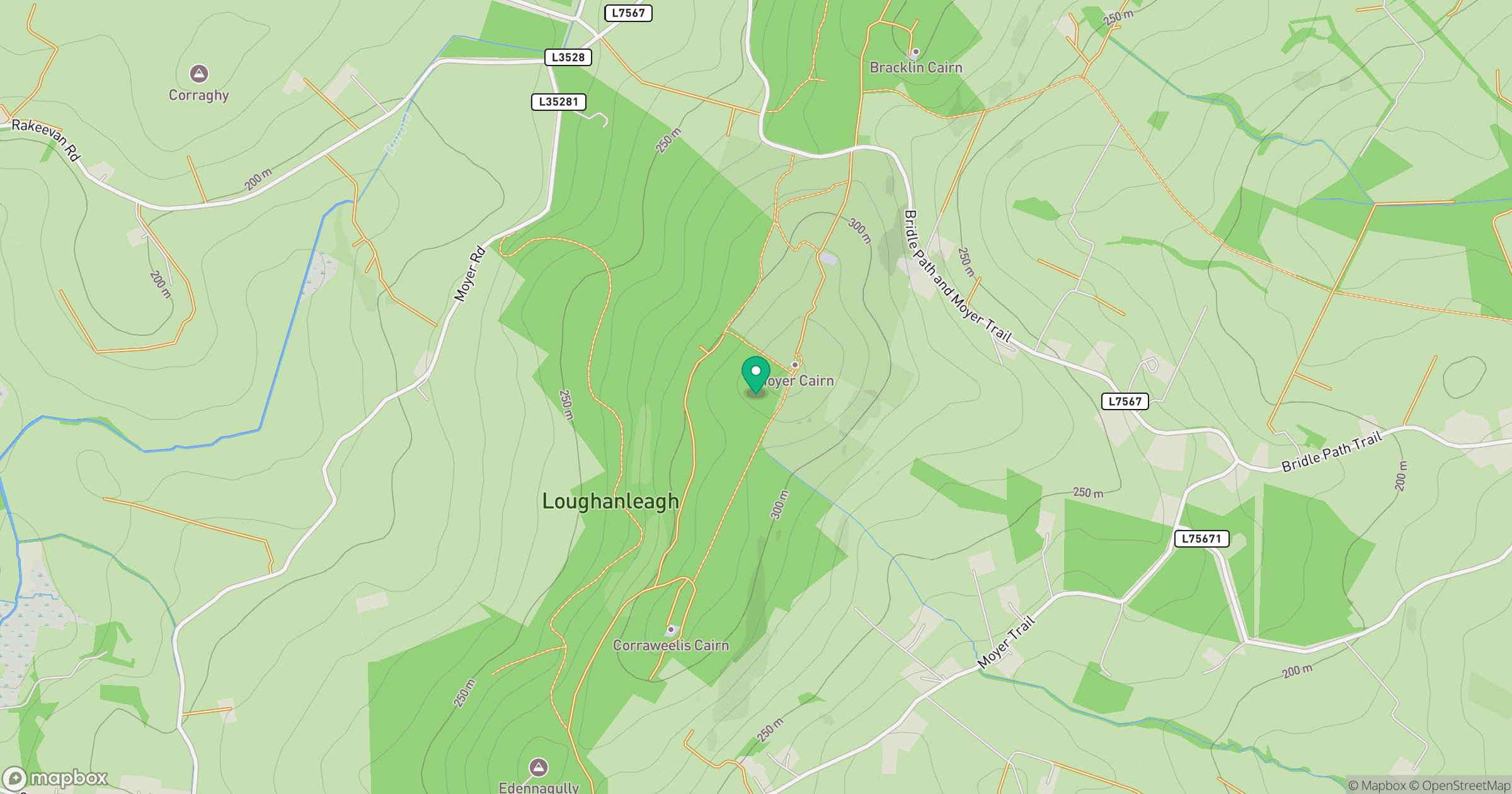
Grid reference: N721959
View on OpenStreetMapOpens a map in a new tab, centred on the hill.
Hills within 30 km
Straight-line distance, not a walking route or confirmation of access.
Carrickleck Hill [Carraig Leice]
173m
Tievenanass
261m
Slieve na Calliagh [Sliabh na Cailli]
276m
Aghalion Hill
249m
Slieve Glah [Sliabh gCleath]
320m
No comments yet. Be the first.